Drag. Drop. Done.
Search addresses, select parcels, or upload shapefiles.

Create consistent, print-ready exhibits with Aerials, FEMA, Wetlands, Soils, Topography and more — all in one browser-based workflow.
Search addresses, select parcels, or upload shapefiles.
Professional layouts, title blocks, legends, and scales.
Instant PDF exports ready for reports and permitting.
Free access through the end of the day after signup, Eastern time. Email verification required.
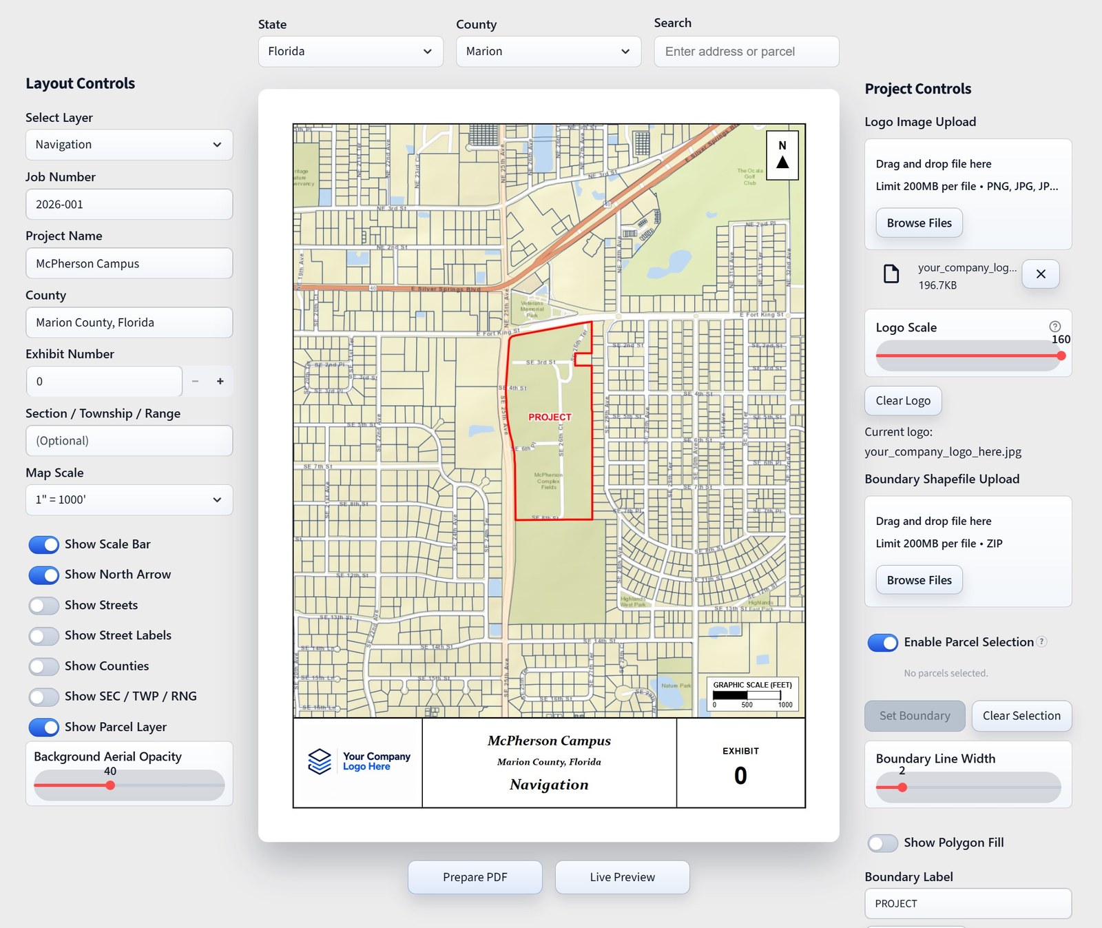
One straightforward workflow, from your first map to your final PDF.
Search addresses or select parcels to define your boundary.
Select pre-built exhibit layouts and toggle map layers.
Add project details and logos with instant exhibit previews.
Export print-ready exhibit PDFs instantly with one click.
The maps you need, with project details, legends, and scales built in.
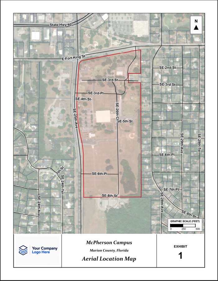
High-resolution aerial context with streets, labels, and project boundary.
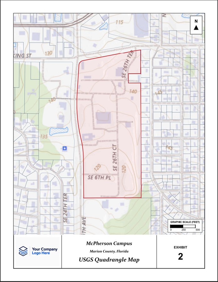
USGS topographic map with contours, hydrology, and land features.
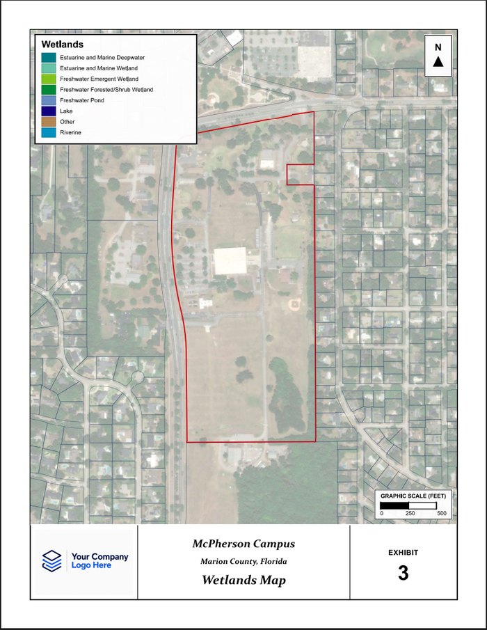
National Wetland Inventory features with official legend and symbology.
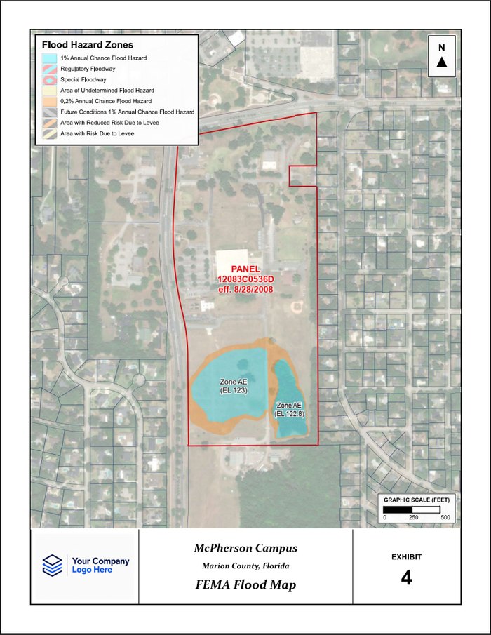
Official FEMA flood hazard layers with zone labels and panel information.
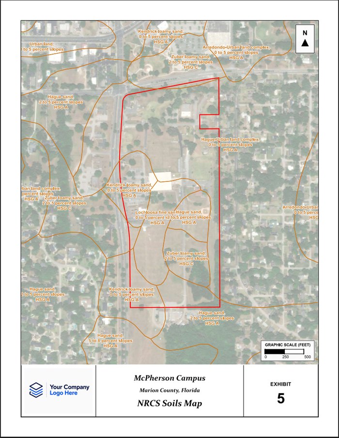
NRCS soil survey data with soil unit boundaries and descriptions.
Start free with all five exhibits and unlimited projects. Choose a pass or Pro when you need more time.
Your trial runs through the end of the day after signup, Eastern time. Email verification required.
Full access for occasional projects.
$10 one-time
Through the end of the day after payment (Eastern time).
Get One-Day PassFlexible billing for ongoing work.
$75 /month
Billed monthly. Cancel anytime.
Start Free TrialYear-round access at a lower cost.
$750 /year
Billed annually. Cancel anytime.
Start Free TrialThe free trial includes the rest of your signup day plus the next full day, Eastern time. Verify your email to use all five exhibits with unlimited projects. The $10 One-Day Pass uses the same rule from successful payment, includes unlimited projects and exhibits, and does not renew automatically. For example, signing up or paying on Saturday gives access through Sunday; access ends Monday at 12:00 AM Eastern. Resending a verification email does not restart the trial.
The app uses authoritative mapping and GIS data from original sources including Esri basemaps and geocoding, FEMA NFHL flood data, USGS topo mapping, USDA NRCS soils data, U.S. Fish & Wildlife Service wetlands data, parcel boundaries, street networks, county boundaries, and PLSS section/township overlays — all combined into fast, print-ready engineering exhibits.
Yes. You can drag and drop or browse to upload a PNG, JPG, or TIFF logo, then scale it to fit the lower-left title block area while preserving its proportions. The title block also includes your project name, county, exhibit number, and section/township/range, while the exhibit title updates automatically based on the selected map type.
We currently offer coverage across the continental United States for most mapping datasets and exhibit types. Full parcel, wetlands, and soils coverage is currently available in Florida. If your state or local dataset is not yet supported, additional coverage can typically be added upon request at no additional charge.
No. The trial ends without an automatic charge, and the $10 One-Day Pass expires without renewing. Neither becomes a Pro subscription. You can buy a pass after your trial or previous pass expires. Pro subscriptions can be managed or canceled through the Account Settings page. Secure payment processing is handled through Stripe, and billing statements will appear as HLC ENGINEERING LLC.
We currently offer individual-user access. Each user maintains their own account, One-Day Pass or Pro subscription, and access credentials. There is no special enterprise or organizational pricing at this time. Teams with recurring exhibit production needs can scale as needed by adding additional user subscriptions.
The core workflow supports export to professional PDF exhibits ready for reports and submittals.